Starts: Mennonite Brethren Collegiate Institute (175 Talbot Ave)
Tour Length: 9.50 km
Introduction
Few people realize that Elmwood started out as one of Winnipeg’s original suburbs. Not so long ago, developed areas of East Kildonan were open prairie. This ride will trace the evolution of this cozy neighbourhood from remote woodlots and farmland, to a bustling hub for industry and immigration. Rail lines and factories gave rise to their own style of distinctly Canadian working-class architecture, standing in stark contrast with monumental churches.
As we tour the historic sites and architecture along the east bank of the mighty Red River, we’ll learn about the unique influences left on the area by its many immigrant communities from Central and Eastern Europe.
Elmwood was a part of the Rural Municipality of Kildonan until 1906, when it became the first outlying area to join the City of Winnipeg. Most other neighborhoods wouldn’t follow officially until 1972. The area’s historical roots lay with the Selkirk Settlers who arrived in the Seven Oaks area on the west bank of the Red River in 1812. Many settlers maintained wood lots here on the east bank, which were gradually cleared and occupied as the west side filled with river lot farms. This side of the river was generally developed later, and most of Elmwood remained fairly rural until around 1900.
Religion & religious architecture are an important foundational element in the area, and are one of the most visible histories left today. After the rail lines arrived in Winnipeg in the 1880s, thousands of immigrants from diverse backgrounds traveled here. Their unique styles of religious architecture were a distinct expression of culture and an important beacon for communities in a distant place. Religious roots here in Elmwood remained so strong into the 1900s that they led to fights with the City of Winnipeg over its lax laws and reputation as a den of vice.
Elmwood’s location along the rail lines and its intersecting key bridges spurred industrial development in the east, giving the neighbourhood a clear border and a distinctly working-class character that’s still seen in its culture.
Tour Stops
For some groups more than others, religious institutions have remained important centres into the present day. The Mennonite community has been heavily represented here since the 20th century, particularly north of Elmwood in East & North Kildonan. The Mennonites are a distinctive religious group that largely immigrated from Germany and have faced significant persecution over elements of their lifestyle, like pacifism.
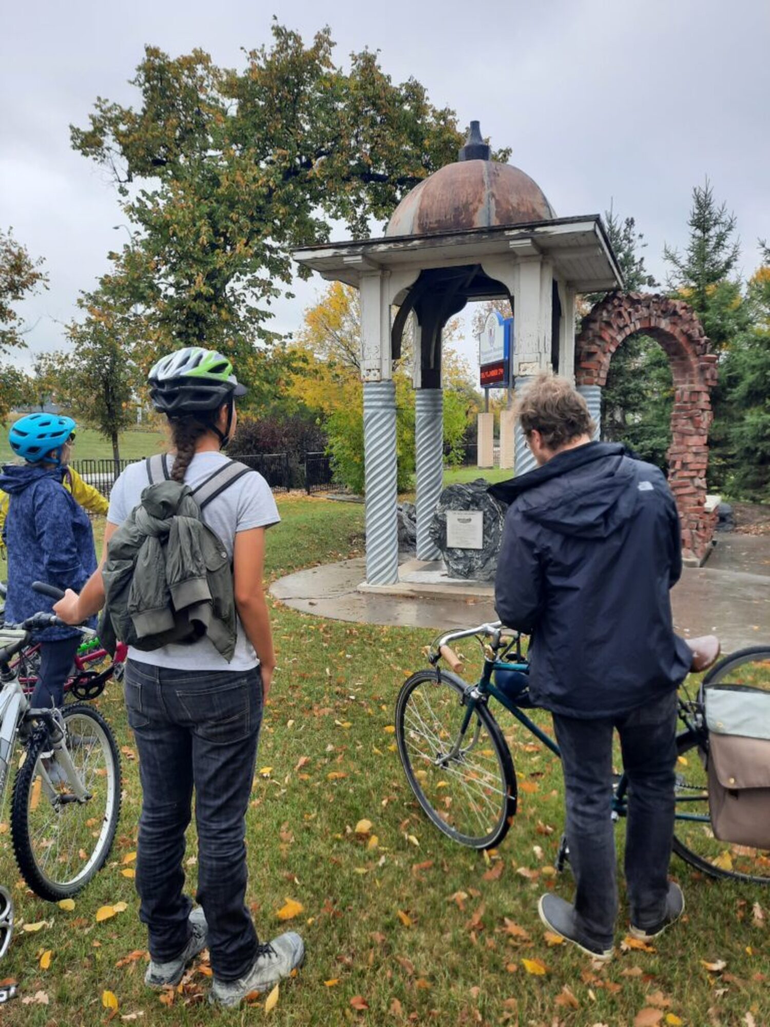
This site was home to the Anna Gibson School, which commemorated Anna W. Gibson (1896-1918), daughter of a prominent timber merchant. She died of influenza while volunteering as a nurse during the 1918-1919 flu pandemic and was buried across the street in Elmwood Cemetery. The primary school was designed by J.B Mitchell and built in 1919. During the Second World War, the school was closed and used to house soldiers. After the war it was used to educate missionaries by the Mennonite Brethren Bible College. The building was demolished in 2005, and the nearby monument was built using an original dome and bricks from the school.
While the area to our north was covered with farms beginning in the mid-1800s, the first urban development in Elmwood started here along the riverside. The first Louise Bridge was built in 1881 in part to carry the CP rail line along with pedestrian & cart traffic from Winnipeg. This area was suddenly linked directly with downtown Winnipeg though the densely populated neighbourhood of Point Douglas. Industrial development followed the rails, and a commercial district popped up along the riverside to serve workers and residents.
The Municipality of Kildonan had a strong religious foundation and was a “dry” municipality that banned any alcohol sales. Tensions quickly flared as liquor flowed across the bridge. The situation escalated when the City of Winnipeg designated nearby Point Douglas as its “segregated vice” or Red-Light District– permitting prostitution within a certain area along Annabella Street.
For many people, this new “Main Street” in their community represented not only prosperity, but creeping modernity and a loss of tradition along with community values. Most public development started to withdraw north into a second “downtown Elmwood”.
The park we just rode through was once occupied by a pork-canning factory owned by The J. Y. Griffin Company. A complex of massive brick factories operated here from 1892 until 1939, when everything was demolished. The owners donated it to the City of Winnipeg and Swift Canadian Park was established in 1944. It was largely undeveloped and used for snow dumping, but was considered as a location for the new Winnipeg City Hall in the 1960s. A major renewal was undertaken in the 1980s, and in 1987 it was renamed after local sports personality and activist, Ernie O’Dowda.
The original Louise Bridge included rail lines which approached the bridge at this spot. When the current Louise Bridge was built 1911, the railway lines were removed and this property was allotted for a park called Louise Square. The site was renamed Midwinter Square later the same year to honour a prominent early resident and politician named Charles Midwinter.
In 1914, Midwinter donated a carved stone bison statue for display in his park. The statue and its base were chiseled from limestone quarried at Garson and designed by local stonemason Arthur Cox. By the 1950s this site was being used as a snow dump, and by 1991 the bison was missing parts of all four legs, its horns and tail. The current replacement was made by a German sculptor named Alfred Widmer and installed in 1995 at a cost of $12,580.
The Canadian Bank of Commerce’s Louise Branch was a stately centre for the emerging commercial strip. It was built in 1906 along Lemoine Avenue (today’s Nairn Ave) for $15,000. The design by the architects Darling, Pearson and Over features standard neoclassical Greek-inspired elements like towering doric columns made of sandstone. Along with the nearby Firehall No. 8, it’s among the oldest buildings left in Elmwood.
Several interesting stone buildings across the street appear to be historic, but date from some time after the 1920s. For many years, the area where they sit was used as a dock for the Paddlewheel Queen riverboat.
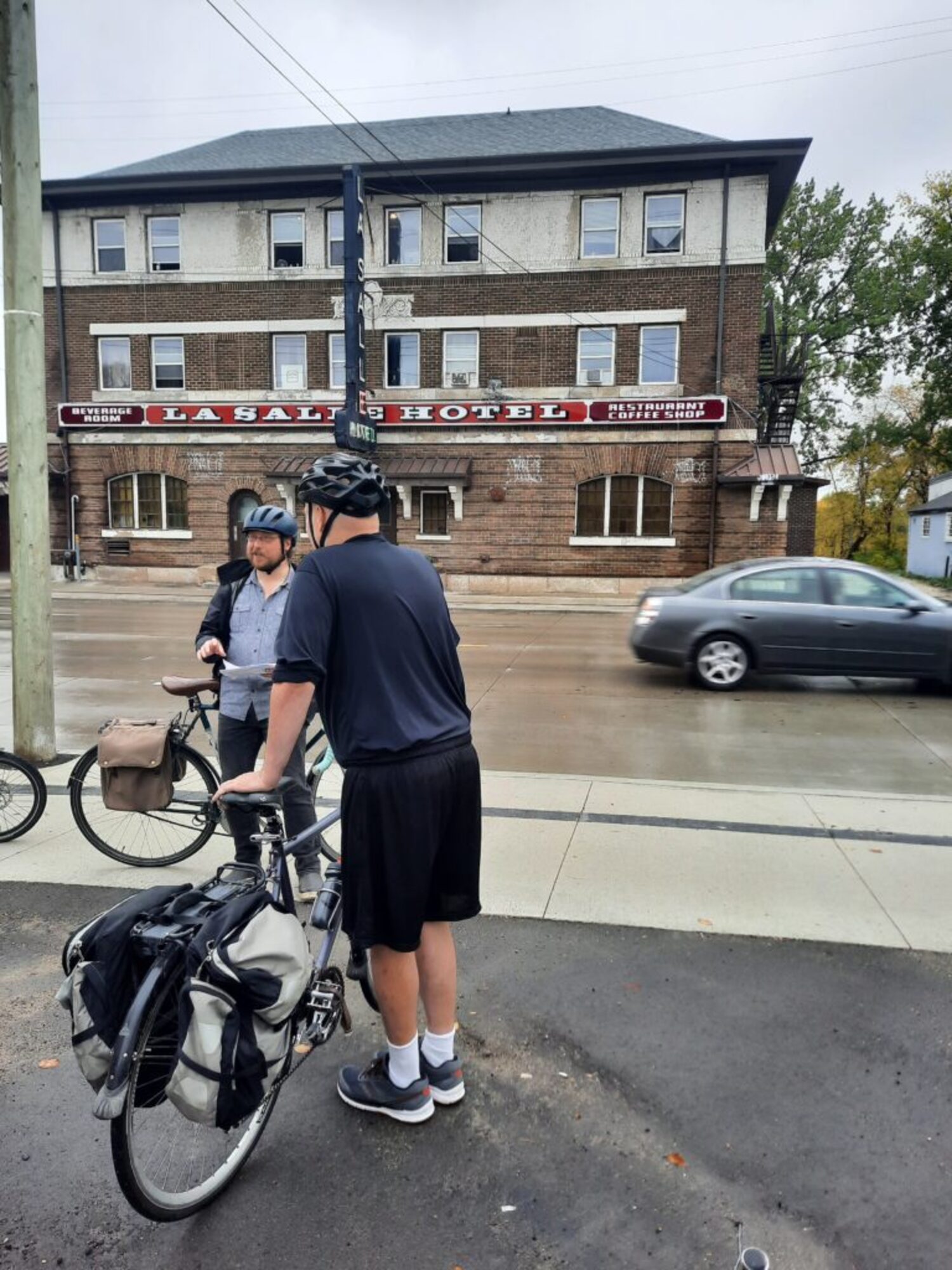
The La Salle Hotel is a large, three-story complex that sprawls down the riverside. It was designed by two local architects named James Chisholm and Colin Campbell “Cam” Chisholm and built in 1914. Beverage rooms like those in the La Salle and its neighbour, the Riverview Hotel, played an oversized role in shaping the community’s development.
The Rural Municipality of Kildonan had an absolute ban on liquor sales. In 1906 the Elmwood area negotiated an agreement to join the City of Winnipeg, based on a promise from Premier Roblin that they could retain their dry status. Immediately after the areas were joined, the Premier went against his word and had a liquor license granted to the Riverview Hotel. He did this by hiding a change to the liquor laws in a last-minute amendment to an unrelated bill, on the last day of the legislative session.
People were outraged, but there was nothing the community could do about it. More hotels and more licenses followed. There was a perception that liquor and vice flowed across the Louise Bridge, and the riverfront district gained a seedy reputation. Although business flourished from the streetcar line running down Nairn, churches and respectable citizens started investing elsewhere. The community’s centre moved to the north-west, and the original commercial district declined.

This park was originally a key line for the Canadian Pacific Railway, built in 1878 and running to St Boniface. It brought major development and created an expansive industrial park along the east edge of Elmwood. Union Avenue hosted several iron foundries and metalwork shops, right next to a school. Local students recall seeing molten metal being poured with smoke billowing out into the street as they walked to class. By the 1990s the rail line had lost its importance and was only being used to store derelict train cars. In 2006 local philanthropist John Buhler bought the abandoned rail land and partnered with the City to create the Northeast Pioneers Greenway – which now runs all the way to Birds Hill Park.
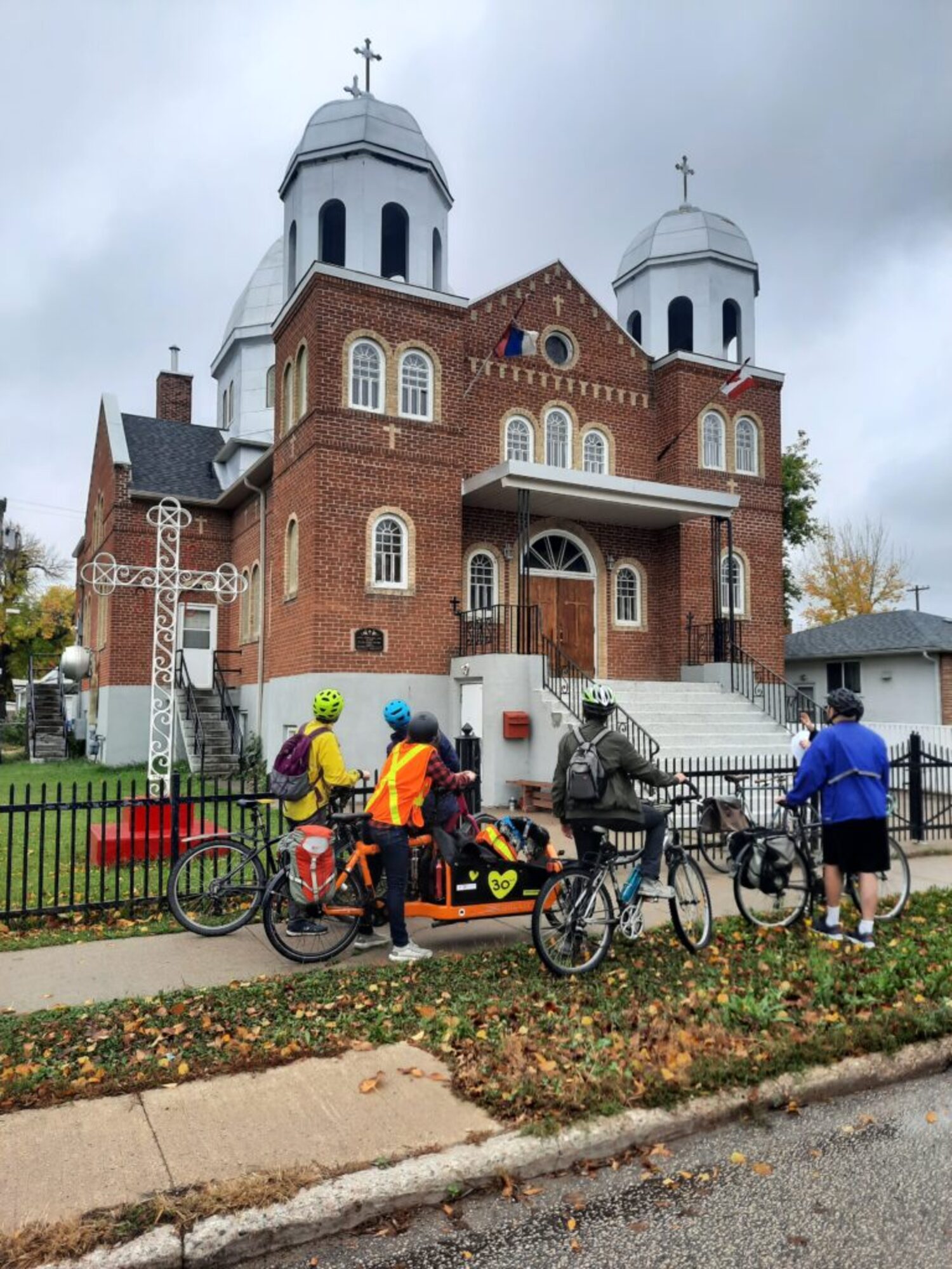
St. Sava Serbian Orthodox Church was built between 1942 & 1952 based on plans by Phillip Ruh, a local priest and architect who designed more than 50 churches across Canada. Originally known as Mother of Perpetual Help Ukrainian Catholic Church, it was purchased by the Serbian Orthodox Church in 1974 as that community grew and became more heavily represented in the surrounding community. Eastern Catholic and Orthodox churches are both heavily influenced by architecture from the Byzantine Empire, and are easily distinguished from most other Christian churches with their domes and cross-shaped layout.
Until a disastrous fire in August of 2023, this site was home to a large wood frame church built in 1911 by architect Leopold Villeroy. Today only the community hall remains. The building was first known as St. Paul’s Lutheran Church and later became the Spanish Church of God. As demographics change, more and more churches face shrinking congregations and evaporating donations. Some are forced to abandon cherished buildings, and many face difficulties with upkeep and limited use, leading to a lack of supervision and tragic losses of community heritage.
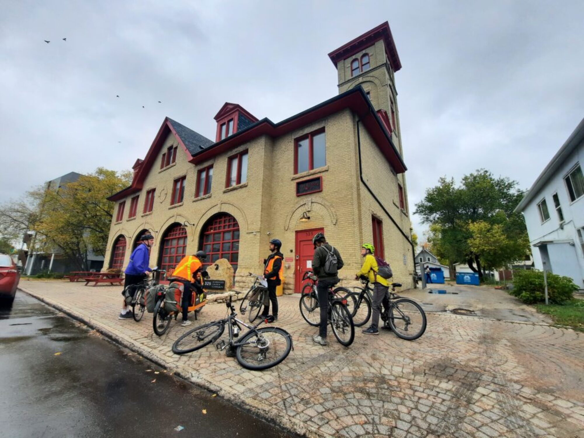
Fire Hall No. 8 was designed by brothers Alexander and William Melville and built in 1906. Similar firehalls were built around Winnipeg at this time, with a design that housed 16 firefighters and 11 horses. The depot was used until 1972, when it was bought by a boxing club and more recently by a community church. The current owners undertook an award-winning restoration in 2014 and provided a wonderful model for the adaptive re-use of community spaces.
In February of 1918, the Riverview Hotel on Nairn Ave, just one block away, caught fire. The commercial street had grown with little oversight, and it was densely packed with hastily built wood shacks. Both sides of the road went up like a match in minutes. At least three people died, as residents leapt out of windows and rushed into burning buildings to carry out children. The only buildings that survived along the main strip were the La Salle Hotel and the Bank of Commerce, both solidly built from brick. According to newspapers, the massive snowdrifts built up around the buildings prevented the fire from spreading further into residential areas.
Henderson Highway became a second “Main Street”, where a true downtown emerged after 1906 when Elmwood joined the City of Winnipeg. They immediately set about planning a new bridge to allow better traffic flow across the Red River and bypass the Louise Bridge. The intersection of Main Street and Redwood Avenue was identified as a key point on the west bank, and the City negotiated with major landowners. There was massive land speculation after the announcement, as investors bought-up farmland with dreams of profitable development. In the end, Drewry’s Brewery and Mr. Hespeler, a wealthy farmer, agreed to give up land for the connection. The Redwood Bridge (today’s Lazarenko Bridge) and Hespeler Avenue were built from 1907-1908, cementing this area as the new commercial district. In the early 1900s the road beside us was known as Kelvin Street. In 1929 it was renamed Henderson Highway after a local politician and longtime president of the Manitoba Good Roads Association; a pro-car development lobbying group.
This long, narrow brick building was built in 1929 for McLean Printers, using bricks imported from Fort William, Ontario. The front half was rented to the Elmwood Branch of the Bank of Montreal, while the back section held McLean Printers and their presses. You can still see the outline of a bricked-up rear entrance along Hart Avenue. For over 30 years, this building was home to the Elmwood Herald community newspaper.
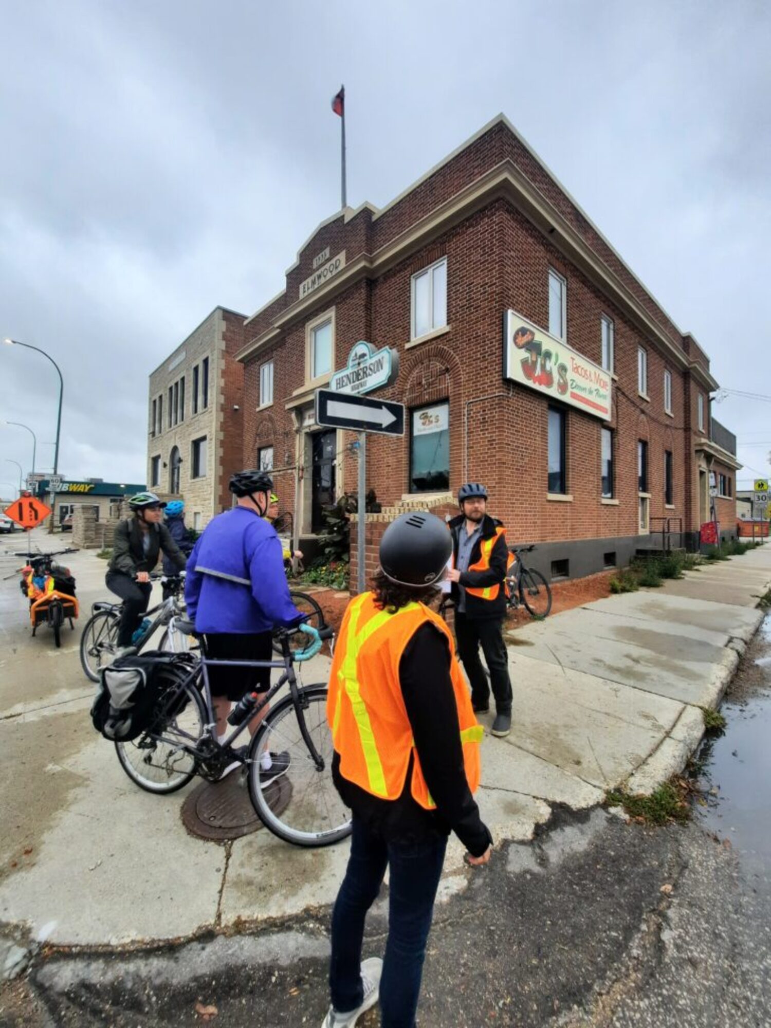
The Elmwood Building was originally built in 1929 as a branch of the Dominion Business College, which had a much larger version of the same design constructed as their head office on Memorial Boulevard (still standing across from WAG-Quamajuq). Its imposing facade was built with local Tyndall stone. The college closed in 1950 and the building became a kind of community centre which hosted banquets, wedding receptions and socials and dances. In recent years it has been turned into commercial and office space.
The Elmwood Post Office (originally called Winnipeg Postal Station F) was built in 1935. Construction was supervised by a local architect named George Northwood, but the federal government erected similar buildings across the country based on standardized architectural plans. A large annex, matching the ornate brickwork of the original building, was added to the back in 1950. After the post office closed in 1992, it was redeveloped into an art gallery and later a restaurant. Many of the neighbourhood’s most important public buildings were clustered together on this block, creating an important community hub. Even the primary school in the area, Lord Selkirk School, was built just behind these storefronts
This house was owned by T.G. Hamilton, a local doctor who became obsessed with psychic phenomena and attempts to contact spirits. Hamilton was a pioneering paranormal investigator who believed that he could use scientific methods to study the supernatural. In 1919 his young son died of influenza, and Hamilton launched his investigations. He worked with a local medium who claimed she could make objects levitate, or manifest “ectoplasm” and visible spirits out of her body. Hamilton took numerous photos and detailed notes of these supernatural events. To a modern eye, most of these photographs are clearly and sometimes even laughably faked. Images of spirits in ectoplasm look like paper cutouts stuck to handkerchiefs, and “levitating” chairs have wires attached. Even so, Hamilton’s work drew incredible fascination that continues today. The house is widely seen as a haunted location and was vacant for many years until Gags Unlimited moved in recently. Despite his unusual interests Hamilton was a respected doctor in the community with a normal practice. The author’s mother went to see him regularly as a young girl.
Gordon United Church was originally built in 1897 as the Louise Bridge Methodist Church, and was located next to the Bank of Commerce that we visited on Nairn Ave. By 1907 the congregation had outgrown their space and purchased this larger lot. They had their wood church cut in half so that it could be moved here, and it was rebuilt with an addition. The building
Originally had a steeply-pitched roof typical for a church, and a tall entrance porch with stairs leading up the front. The shrinking congregation amalgamated with another nearby group in 1967, and the church was heavily renovated into this nondescript apartment building.
This site is home to another former church that’s been converted into a home. St. Cuthbert’s Anglican Church was also founded on Nairn Ave, and the congregation also started building their new home on this lot in 1907. The relocation of multiple institutions like this is a strong indication that the heart of the community was moving north, away from the waterfront with its nearby heavy industry and hotel bars. St. Cuthbert’s closed in 1973 due to a shrinking congregation, and several buildings were demolished. The building that remains here was the rectory (priest’s residence) built in 1921.
The Elmwood Telephone Exchange Building was built in 1928 for the Manitoba Telephone System. It has a very strong art-deco style, with geometric stonework designs along the roof. Its stout walls & top ridge design suggest something almost like a castle – a very ‘strong’ public building which represented the expansion of modern services into the neighbourhood in a distinctly modern building. It was designed by local architect Alexander D. Melville and cost approximately $35,000. It has now been renovated into a residential building that retains some interesting historical touches.
This unassuming home is among the oldest buildings left in Elmwood. It’s known as Goldfind House, after its first owner, Jacob Goldfind. It was built in 1910 based on a design by Max Zev Blankenstein, the first Jewish architect to practice in Manitoba. Blankenstein immigrated from Russia in 1904 and designed numerous buildings around Winnipeg, particularly in the North End, up until his death in the 1930s. He is most famous for designing the elaborate Uptown Theatre on Academy Road, but he was also responsible for Elmwood’s local theatre, which we’ll visit soon.
Many of the areas that people consider part of Elmwood today, like where we stand now just south of Munroe Avenue, are actually in East Kildonan. The official border of Elmwood has always been at Harbison Avenue, seven blocks to the south. The large Rural Municipality of East Kildonan was based near here on Henderson Highway. Development proceeded north along the Highway quickly, but until the mid-20th Century this was a mostly rural area.
This home was originally built along Henderson Highway in 1902, and was owned by a municipal official named Albert R. Bredin. The Rural Municipality of East Kildonan incorporated in 1940 and converted Bredin’s house for use as the municipality’s offices. It served this public function until 1951, when it was moved to its present location and renovated back into a private residence.
It’s surprising how often we encounter large historical buildings that have been moved. Today most people would hardly consider it a realistic option, but in the 19th and early 20th centuries it was a very common practice. Houses were lifted onto skids made from greased logs and were rolled to their destination by teams of heavy draft horses. One family in West Kildonan recalled moving their house two blocks down the street in the 1940s, so that they could hook up to the new municipal sewage and water lines.
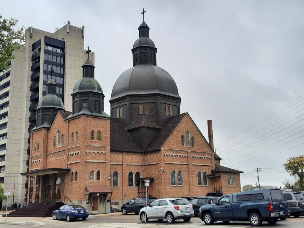
Holy Eucharist Ukrainian Catholic Church was built in 1954 to replace an earlier church on the same site. Just like St. Sava’s that we visited earlier, it was designed by the famous eastern Catholic priest and architect, Father Phillip Ruh. Complex ornamentation carved into the arches and pillars was done by an artist named Sviatoslav Hordynsky, while the stained-glass windows were made in 1971 & 1986 by famed Ukrainian-Manitoban artist, Leo Mol. The interior domes are fully decorated with elaborate paintings of Jesus & the apostles and a large iconostasis. Across the street from the church sit a priest’s residence built in 1974, and a parish hall built in 1983.
Glenelm is the small section of Elmwood which runs between Henderson Highway & the Red River. It was originally the wealthiest part of the area, and we’ll see some very impressive, large homes from the early 1900s as we explore. There are several large European terrace-style multi-family homes that have been converted into condos, while others have deteriorated into run-down apartments. All this historic architecture is surrounded with small working-class homes from the mid-1900s, giving the mature neighbourhood an eclectic look.
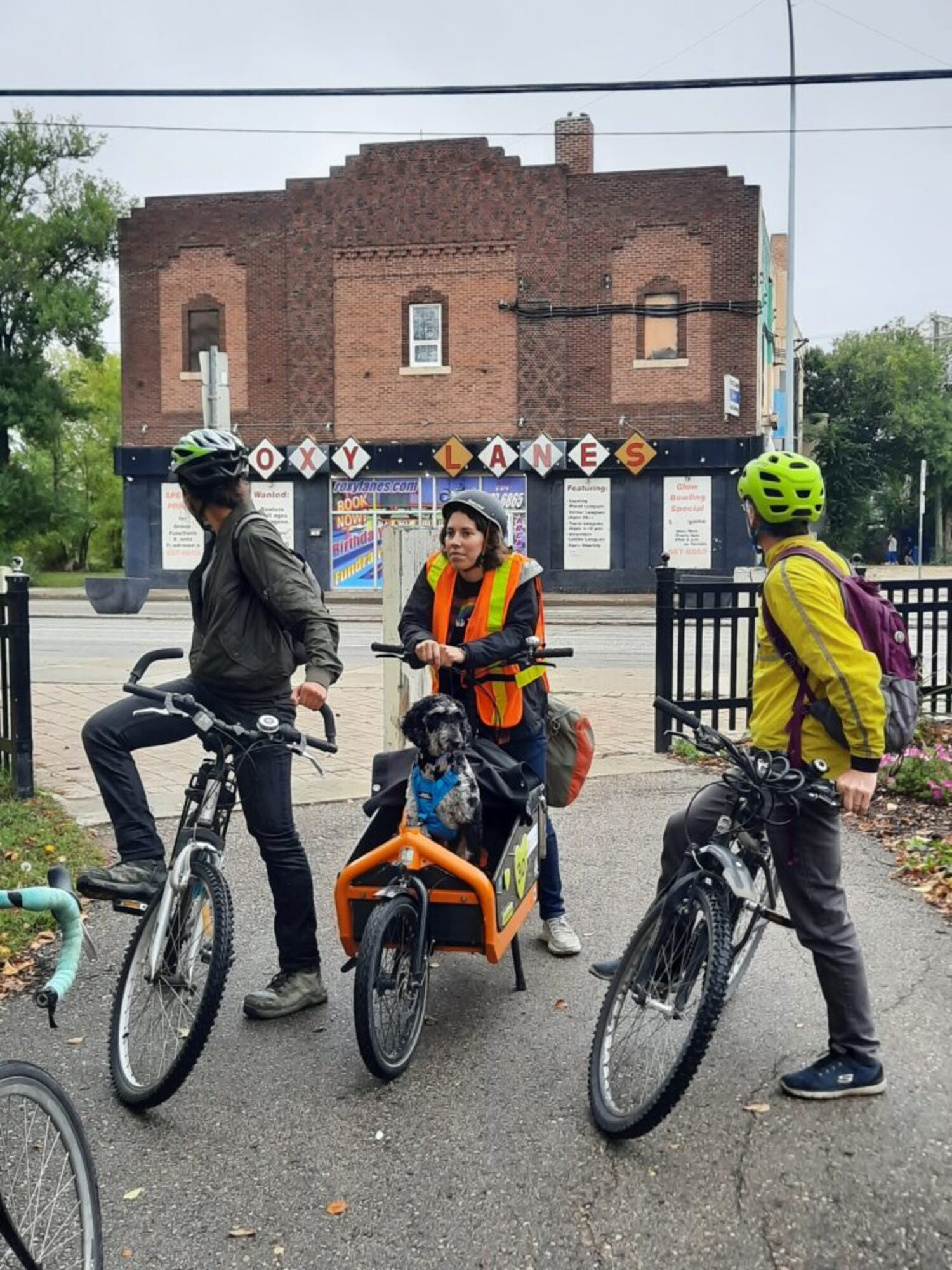
The Roxy Theatre was built in 1929 for the astronomical cost of $150,000 ($2.6 million in 2024), based on designs by the famed local architect Max Zev Blankenstein. The two-storey theatre seated 1,200 people and featured an elaborate, fantastical interior. The walls were decorated to imitate Spanish homes with sloping tile roofs and draperies, while the ceiling was painted with a sky-blue mural which incorporated twinkling lights to imitate stars. The lobby held a massive stone fireplace. Drivers along Henderson Highway were drawn in by a 10-foot high neon sign.
The theatre operated for over 30 years and was converted into a bowling alley in 1960. Roxy Lanes operated for another 62 years, finally closing in 2022. The building was recently purchased by the Manitoba Metis Federation, which plans to demolish it and build a housing project on the site. There has been vocal opposition from residents in the area who have generations of memories tied to this highly-visible centre for recreation, but a campaign to obtain a heritage designation was unsuccessful.
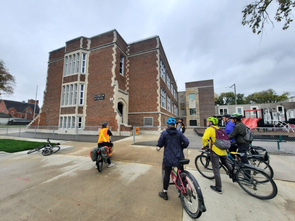
Glenelm School was built in 1929 for the Winnipeg School District with input from three local architects: William Martin, George Northwood and Cyril Chivers. The additions were built in the late 1980s and late 1990s. The building itself is concrete, but its brick facade includes ornate Flemish masonry patterns and a much larger number of windows than we’d typically see in a public building of this age. In recent decades, many school divisions in Winnipeg have instituted a policy to brick up or cover the majority of school windows to save on heating costs. The school has an unusual layout, with the building situated in the middle of its property. This was done intentionally to create separate outdoor playgrounds for boys on the east side, and girls on the west. The school was originally called Glenwood School, but in 1948 it was renamed to avoid confusion with the Glenwood area of St Vital.
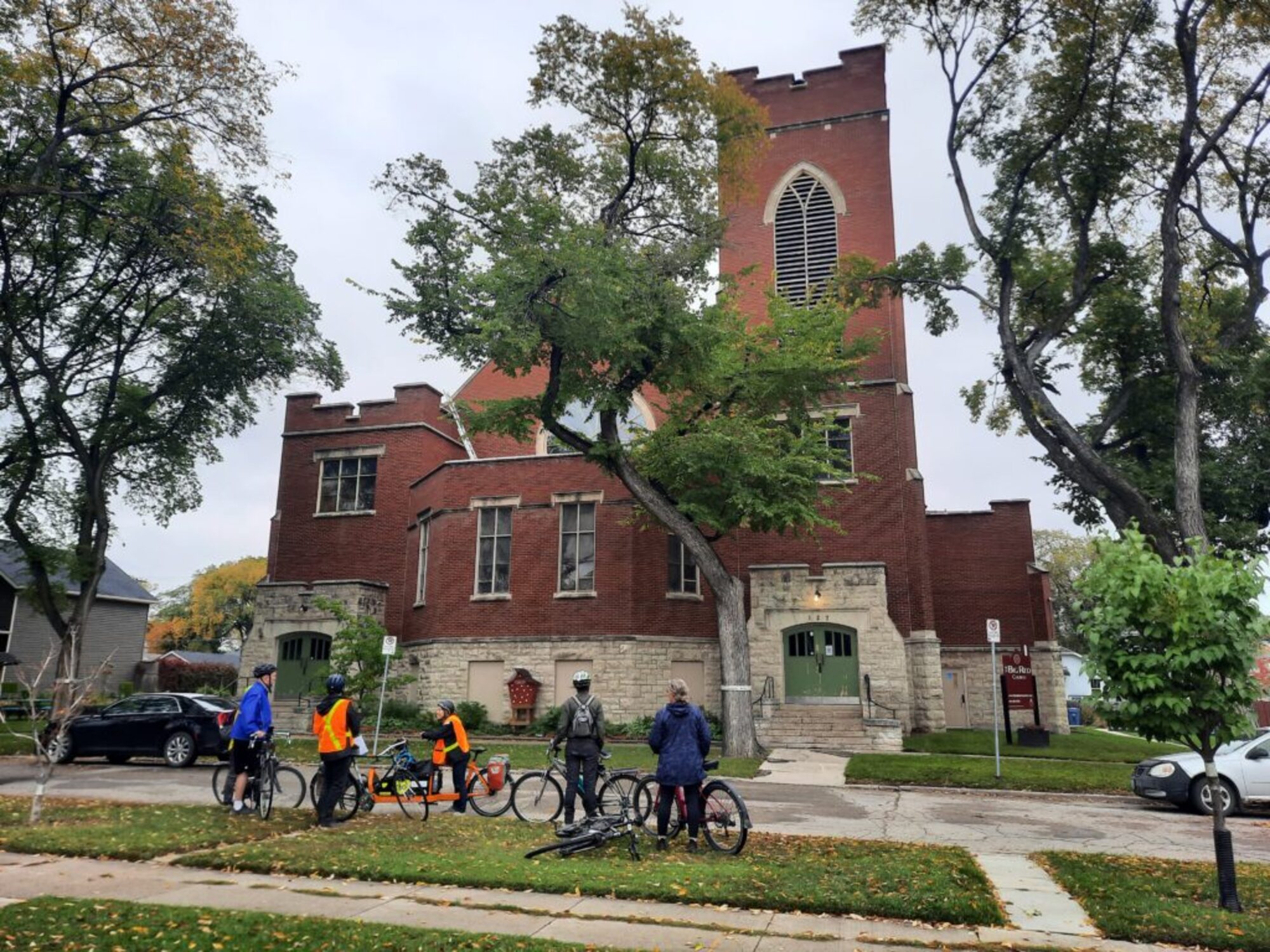
This church began as the Elmwood Mission, a group that gathered in the early 1900s near the starting point of this tour. The congregation grew and acquired this land in 1913. In 1914, they built a covered basement that seated 700 people. A massive pipe organ costing $8,500 ($225,000 in 2024) was installed in the basement, and the congregation worshipped underground for 13 years while raising the necessary funds to complete the grand church above them. The building we see now opened on October 2, 1927. It holds 1,000 people and originally had 25 Sunday School classrooms. It has remained in use through at least six church amalgamations and name changes.

As we wind through this scenic and historic cemetery, we’ve literally been riding past the trees that named this neighbourhood.
Construction started on the Elmwood Cemetery in 1901. The work was met with tremendous outrage from nearby landowners, like Mr. Hespeler. 98% of the project’s funding was raised from investors in Eastern Canada, with only 2% contributed by Winnipeg locals. The Municipality of Kildonan argued that this prominent location across from the growing City of Winnipeg was a terrible spot for a cemetery. It would exempt a massive piece of valuable land from development and taxation. The provincial authorities ignored the local protests and approved the project. It opened in 1902 and was named after the many old-growth Elms spread throughout the grounds. In the early 20th Century there were far fewer graves and the site was treated like a large riverside park, used by the community for picnics and recreation. Countless noteworthy and average citizens are buried here, including names like Gordon Bell, Bill Norrie, Dufferin Roblin, and LB Foote.
By the time this neighbourhood petitioned to join Winnipeg in 1906, the whole area was known generally as Elmwood. This is a remarkable situation where the community has proudly adopted its name from a once-hated development.
The Pedal into History project was supported by contributions from the Province of Manitoba through the Heritage Grants Program., the City of Winnipeg, and Seven Oaks House Museum. We are grateful for their support.
